
Stonewells and its lands
Reputedly the oldest building in the village apart from the church the history of Stonewells can be traced with certainty to 1623. Earlier than that we are into the mists of time but some conjectures can be made. It had many owners and was a farmhouse for most of the time, but from 1932 became primarily a private residence later split into two.
The house today.
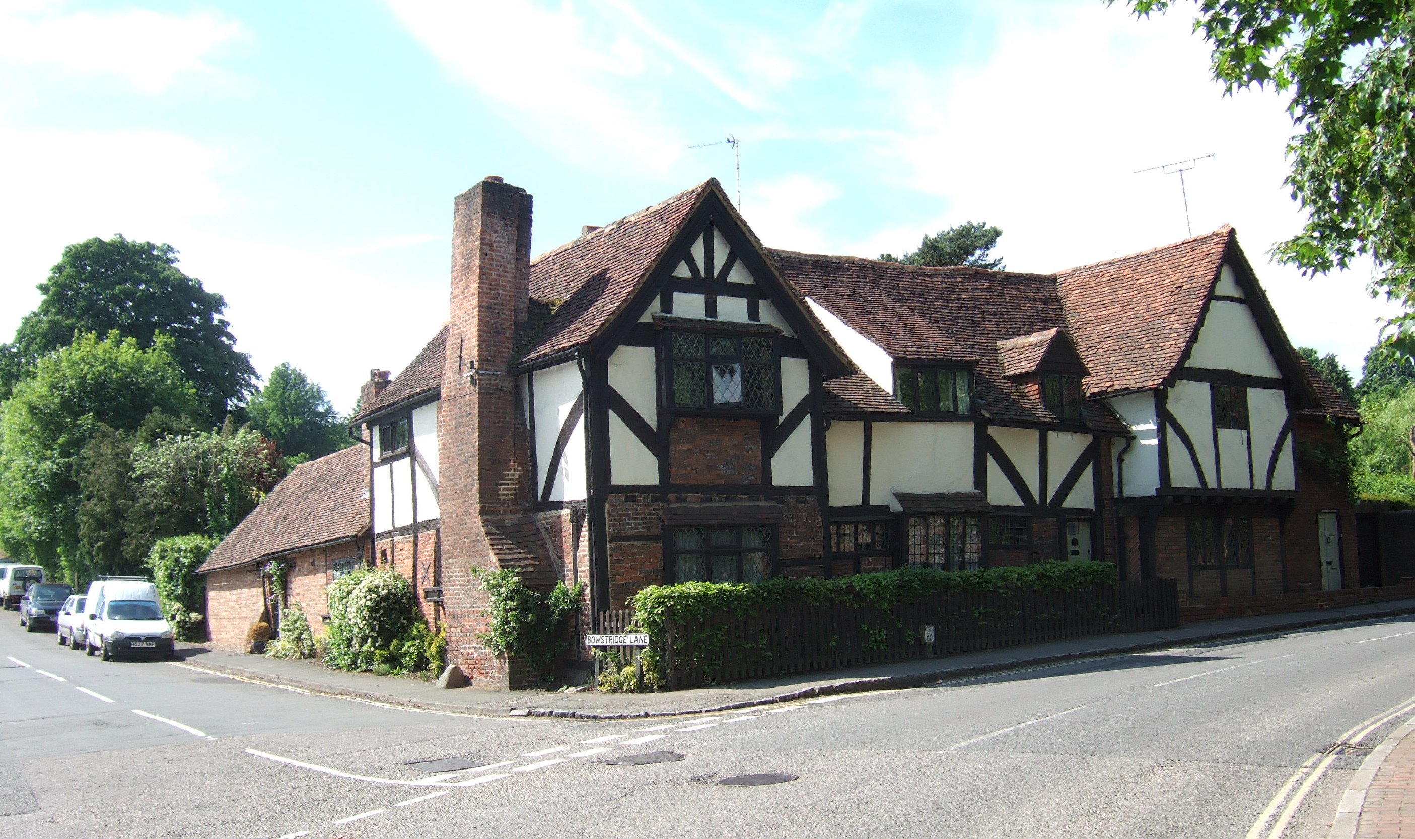
The original building is basically the same structure as it has been since very early times but has been maintained and extended and now forms two residences, Stonewells Farm and Stonewells Cottage.
As it was in 1909.
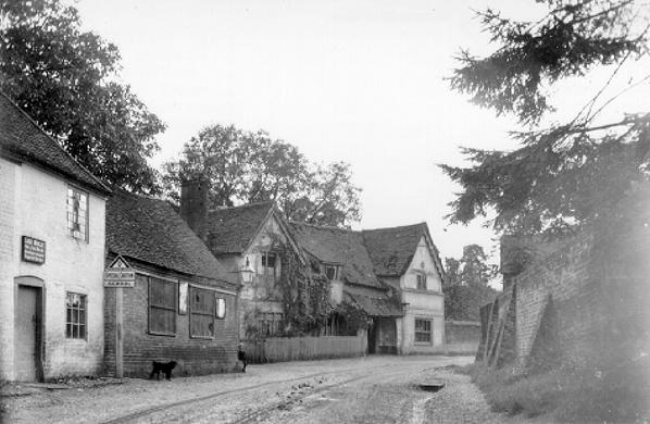
This is the earliest picture there is and shows it in a very sorry looking state needing some TLC.
The Structure.
It is Grade II l Listed. Built in the late 1400s-early 1500s, and comprising the original hall and two cross wing of the Medieval building. It retain the major part of the Medieval timber frame, together with 17th century alterations to add chimneys and windows, and to convert the hall to two storeys. Other historic adaptations include the replacement of many of the ground floor wall panels in 17th and 18th century brick. The building was extensively refurbished in the early 1950s, and subsequently extended.
The name.
In almost all Deeds it is referred to as "Stonors or Stonewells".
Location.
This is a high status building when it was constructed yet it is on a very constrained site. This may account for the fact that the east wing projects to the south whereas the west wing projects to the north. Being at one end of the village reinforces its status
History of the farm and its lands.
The ownership has been traced with some certainty from 1623 up to its ownership in the 1980s and some conjectures are made about its prior history. Twice it was part of the Vache Manor and once probably part of the Grove Manor. It has at times been a separate freehold farm, owned and occupied by the same people, at other times it has been leased out to tenant farmers. As well as a farm in more recent times has it included a butchers shop.
The extent of the lands associated with the house has varied with the owners and the evolution of these various parcels has been established as far as possible. They are shown as various coloured blocks on the map below.
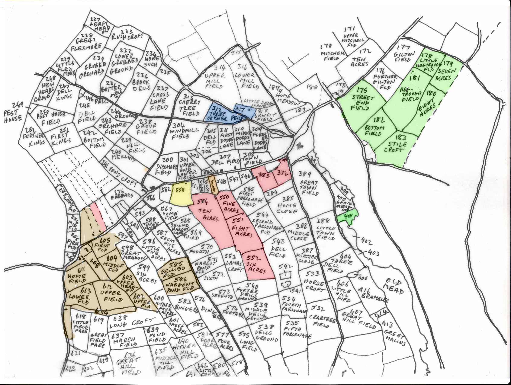
This map is based on the Tithe Map of 1840 and shows the field names at that time. The centre of the village has been left blank but can be identified by means of the church. Stonewells Farm occupies parcel 372. It has been possible to correlate most the pieces of land in all the Deeds primarily through the locations described in the Deed of 1829.
A timeline of its history and its owners is shown on a separate page.
REFERENCES. Unless otherwise specified, all references given above refer to catalogue references at the Centre for Buckinghamshire Studies at Aylesbury. (County Record Office.)
This print is a section of the Chalfont History website.
Please come back soon.
John Dodd ©2012 www.chalfonthistory.co.uk